REPEATER SITES
The Waikato VHF Group owns and maintains a number of repeaters and beacons in the greater Waikato and Bay of Plenty area. Sponsorship
SELECT A SITE... or scroll down
TE WERAITI
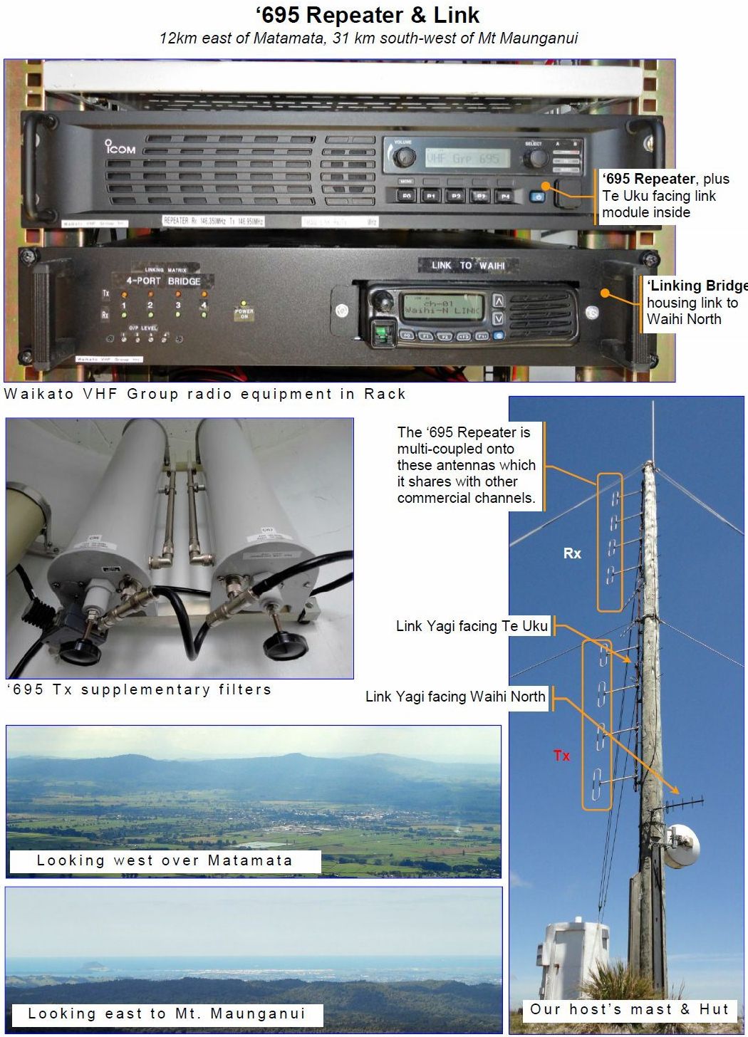
2m Repeater Trustees - ZL1TAT & ZL1THG, 70cm Link Trustees - Ian Brown ZL1TAT & Tom Bevan ZL1THG
Topo 50 Map Reference - BD36 558 104 Map
Te Weraiti Photos....
Te Weraiti where ‘695 is situated is on private land approximately 0.5km north along the ridge from Civil Aviation’s Secondary Surveillance Radar (SSR) (the “golf ball”), and 5.2km north of the SH29 road summit. SSRs interrogate a transponder on each aircraft to obtain flight data additional to bearing and distance obtained from Primary Radars. Further info SSR
TE UKU
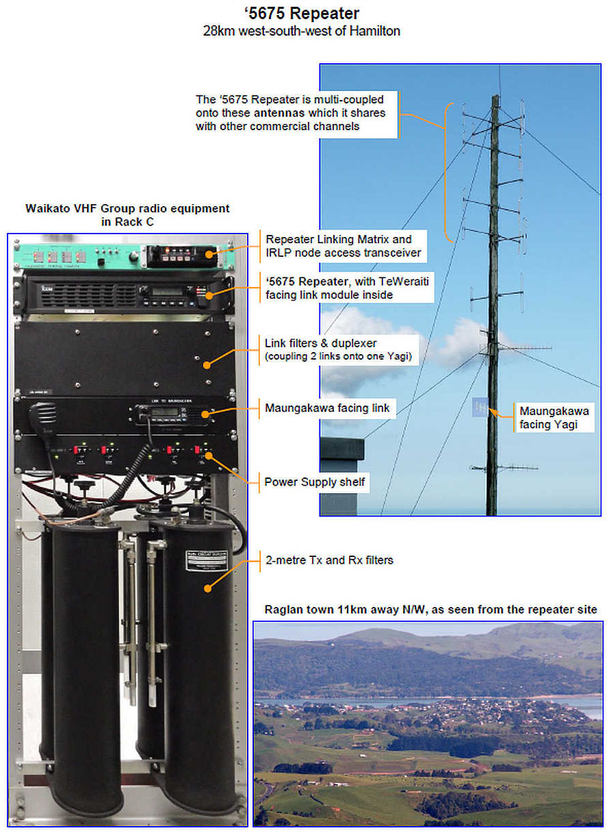
2m ('5675 MHz) Repeater Trustees: Ian Brown - ZL1TAT & Tom Bevan - ZL1THG
Topo 50 Map Reference - BD32 733 067 Map
Te Uku Photos....
Te Uku Wind Farm with 28 turbines totalling 64 Megawatts (MW) on the Wharauroa Plateau adjacent to where our ‘5675 repeater is sited. Each wind turbine is supported by a 130.5m high tower manufactured in Korea, and topped by a Siemens 2.3MW generator made in Denmark. Construction was completed in March 2011, at a cost of $200 million. The wind farm which is controlled from Meridian Energy’s Hydro and wind control centre in Wellington covers an area of approximately 200 hectares (2.0km2) on private land, and is jointly owned by WEL Networks and Meridian Energy.
WAIHI NORTH
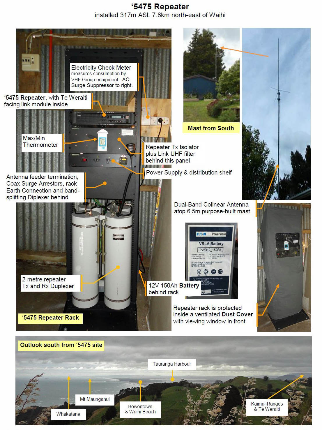
2m ('5475 MHz) Repeater Trustees: Ian Brown - ZL1TAT & Ross Walker - ZL1AAF
Topo 50 Map Reference - BC36 587 609
KAIMAI
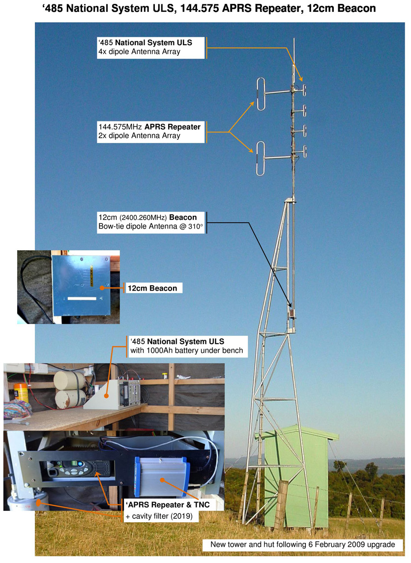
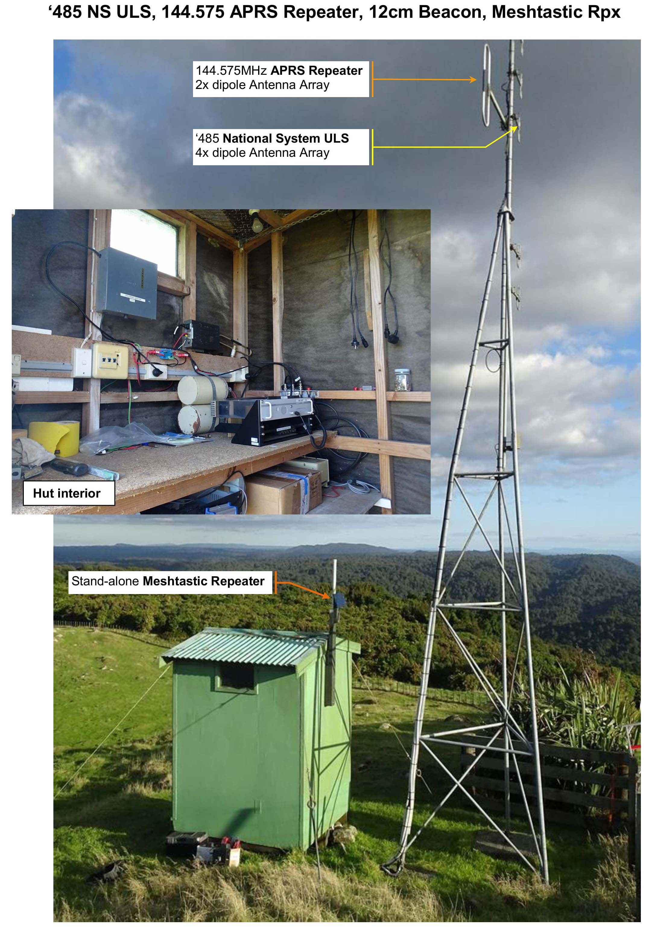
National System ULS Trustee - Neill Ellis - ZL1TAJ & Dennis Seymour - ZL1UET
APRS Repeater Trustee - Warren Harris - ZL2AJ
12cm Beacon Trustees - Tom Bevan ZL1THG & Dennis Seymour - ZL1UET
Topo 50 Map Reference - BD36 583 034 Map
RUKUHIA
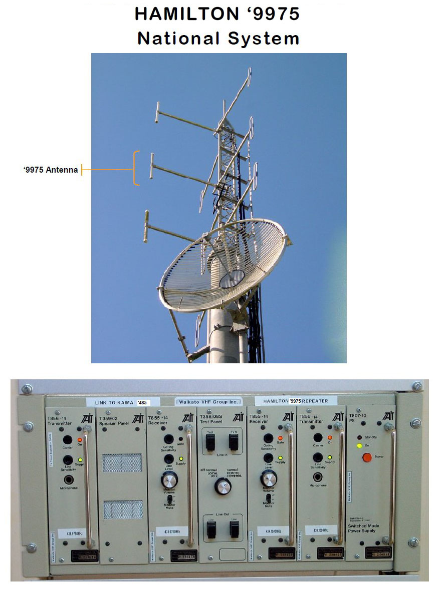
National System ULS Trustees: Ian Brown - ZL1TAT & Tom Bevan - ZL1THG
Map Reference - BD33 027 103 Map
IMAGES